
Part 2: The Making of North Point’s Oddly Disjointed Waterfront
And the HK$1.18 billion project to fix it
For the 2024/25 Coastal Trail Challenge, we are collaborating with Parks and Trails to highlight stories behind some the less well-known places along Hong Kong Island’s coast.
The first part of this series explained how Li Ka-shing amassed 25% of the length of North Point’s shoreline. His two largest properties, Provident Centre and City Garden, provide little to no public waterfront access. However, the responsibility does not only lie with private developers. The government had the tools to ensure public access to the waterfront, and if it had made certain decisions differently, North Point would be in a very different situation today.
A costly oversight
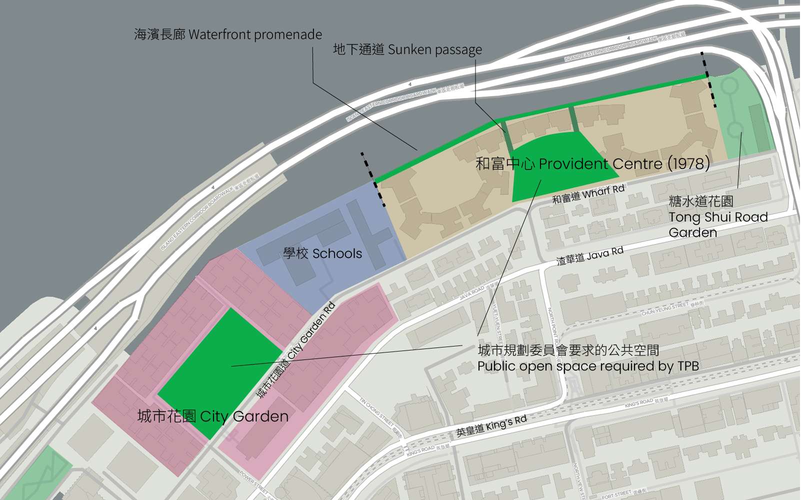
In the late 1970s, the Town Planning Board started experimenting with a new type of zone, “Comprehensive Development Areas” (CDAs), to facilitate and control the redevelopment of large sites. Developers have to submit a detailed master plan to the TPB for approval, which gives it the ability to scrutinize the design and impose requirements, including the construction of community facilities and public open space. Both Provident Centre and City Garden were treated as CDAs.
When Hutchinson Whampoa applied to build the Provident Centre in 1978, they were required to build 5,200 sq.m of public open space, including a playground on Wharf Road and a 5m wide waterfront promenade. However, no apparent attempt was made to connect the promenade to sites on either side of the development. When the then-Urban Council was presented with the design, the only concern anyone expressed about the promenade was that it might be negatively affected by the construction of the Island Eastern Corridor. No-one seemed concerned by the fact that the promenade could only be accessed by two sunken passages in the middle.
The Urban Council’s biggest point of contention was land ownership: the playground was located on the roof of an underground shopping centre, so while the developer was supposed to hand the open space over to the government to manage, it could not surrender ownership of the land.
Two years later, the TPB similarly required Cheung Kong to build 5,420m2 of public open space at City Garden. Yet none of it was on the waterfront, but on the inland side facing City Garden Road. If any lesson was learned from Provident Garden, it was to avoid another land ownership dispute with the Urban Council. This time, Cheung Kong would remain in charge of managing the public space, which was located over an underground car park. There was also a site reserved for schools between the two housing developments, but the government did not retain that part of the shoreline for public access either.
From solution space to public asset
In hindsight, it is hard to explain these decisions. Maybe the planners lacked experience as CDAs were still a new mechanism. Perhaps they thought that with the construction of the Island Eastern Corridor (1978-1986), the waterfront would not be very pleasant anyway. In general though, the government then saw the waterfront as a “solution space” to put necessary infrastructure and public facilities. Private waterfront development also provided much-needed housing and commercial space, while generating land revenues to pay for further large infrastructure projects. Pedestrian access was nice to have, but not a must.
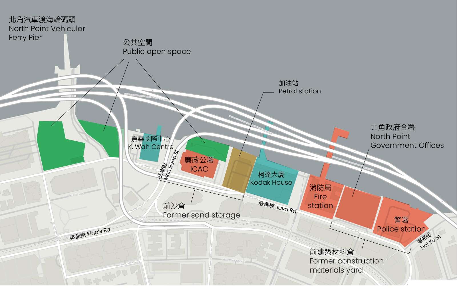
In the early 1980s, the government vacated its sand and construction materials storage depots on North Point’s eastern shore. However, instead of designating the land for public enjoyment, most of it was allocated to new government buildings. Several disconnected sites, two near the vehicular ferry pier, and one behind the present-day ICAC building, were zoned as open space to make up for the district’s shortfall, providing isolated pockets of waterfront access.
The government was pushed to change this approach by strong public opposition to further harbour reclamation in the 1990s. With the passage of the Protection of the Harbour Ordinance in 1997, and the establishment of the Harbourfront Enhancement Committee in 2004 (which later became the Harbourfront Commission), the government had to completely revise its policies. Victoria Harbour was defined as a “public asset and a natural heritage of the Hong Kong people”, and the goal of creating a continuous promenade was set.
Gradually, quality control over private waterfront developments improved. While current practices are not perfect, it is now standard for developers to be required to build waterfront promenades and either manage them for public use, or hand them back to the government upon completion. This is what occurred when the North Point Estate site was sold to Sun Hung Kai for redevelopment in 2013. However, fixing North Point’s overall situation would require a much bigger solution.
Building the boardwalk underneath the Island Eastern Corridor
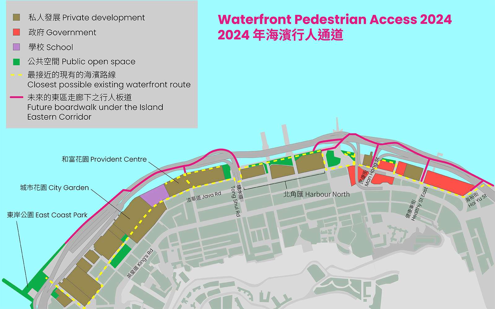
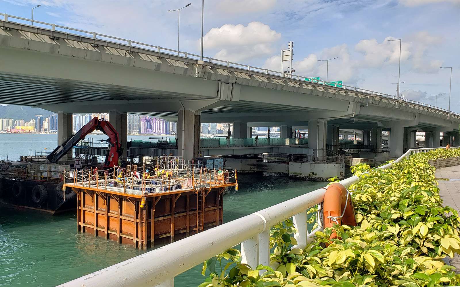
The idea to build a boardwalk under the Island Eastern Corridor first came out of a public engagement exercise in 2005-6. The idea was endorsed by the Eastern District Council in 2007, then formally adopted by the Planning Department in its 2009-12 study on enhancing Hong Kong Island East’s waterfront. As it would be so difficult to change the existing land use situation, the government would build a boardwalk on the outside, underneath the elevated highway. However, it would take another decade to be implemented. In December 2021, the government awarded a HK$1.18 billion construction contract to build the boardwalk.
It took so many years because of a potential legal snag. The government’s 2012 engineering study found that although most of the boardwalk could be attached to the existing Island East Corridor’s columns, it would still be necessary to install some new support pillars, which technically counted as reclamation. In 2004, the Court of Final Appeal had ruled that under the Protection of the Harbour Ordinance, reclamation could only take place if there was an “overriding public need”. To make certain that the project met the legal definition of “overriding public need” and that no other options were feasible, the government conducted a second study in 2015, accompanied by a 3-stage public engagement from 2016 to 2019.
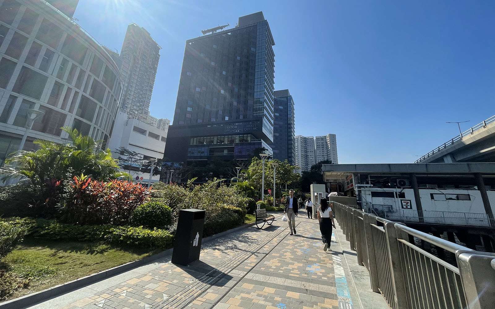
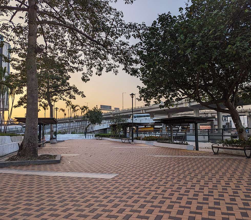
When it is completed in 2025, the boardwalk will connect East Coast Park to the Quarry Bay Promenade, linking to North Point in several places, including Provident Garden’s isolated promenade, the existing ferry pier promenade, Man Hong Street, and Healthy Street East. There will be a cycle track, food kiosks, fishing platforms, and viewing decks, giving residents of North Point the promenade they should have had all along.
Sources
Town Planning Board, “North Point Outline Zoning Plan No. LH 8/35B”, July 1981, TPB, Hong Kong Government.
Town Planning Board, “Amendments to Draft North Point Outline Zoning Plan NO. LH 8/35D”, August 1983, TPB, Hong Kong Government.
Town Planning Board, “Draft North Point Outline Zoning Plan S/H8/27”, 24 March 2023, TPB, HKSAR Government.
Town Planning Board, “Town Planning Board Guidelines for Designation of ‘Comprehensive Development Area (“CDA”) Zones and Monitoring the Progress of ‘CDA’ Developments”, TPB PG-NO. 17A, April 2016, TPB, HKSAR Government.
Urban Council Recreation and Amenities Select Committee, “Dedicated Open Space at Wharf Road”, Ref. : USDP 42/441/78, 2 January 1980, Urban Council, Hong Kong Government.
〈會德豐港燈急升〉 (“Wheelock and Hong Kong Electric surges”), Kung Sheung Evening News, 12 November 1980.
MVA Hong Kong Ltd., “Balancing the Need to Travel with the Need to Improve Our Quality of Life”, Harbour Business Forum, February 2008.
Carine Lai, “Private Development and Management of Public Open Spaces on the Victoria Harbour Waterfront”, Civic Exchange, October 2021.
Civil Engineering and Development Department, “Boardwalk Underneath the Island Eastern Corridor—Project Overview”, 22 June 2022, CEDD, HKSAR Government.
Civil Engineering and Development Department, “Agreement No. CE 29/2019 (CE) Boardwalk underneath Island Eastern Corridor Design and Construction—Cogent and Convincing Materials (Final)”, December 2020, CEDD, HKSAR Government.
Planning Department, “Planning Brief for the Proposed Developments at the Ex-North Point Estate Site, North Point”, January 2011, PlanD, HKSAR Government.

