Photo credit: Joshua Wolper, May 2024
Photo credit: Joshua Wolper, May 2024
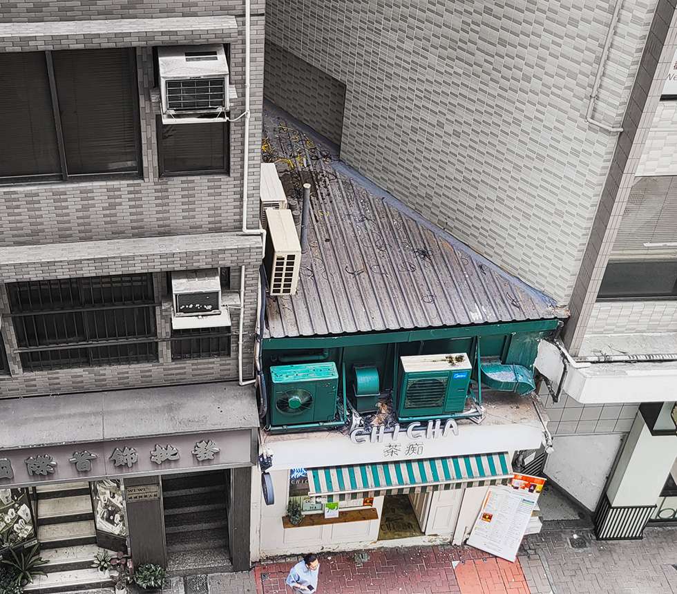
It’s 145 square foot building
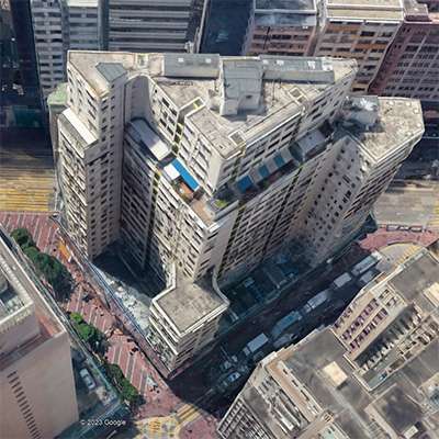
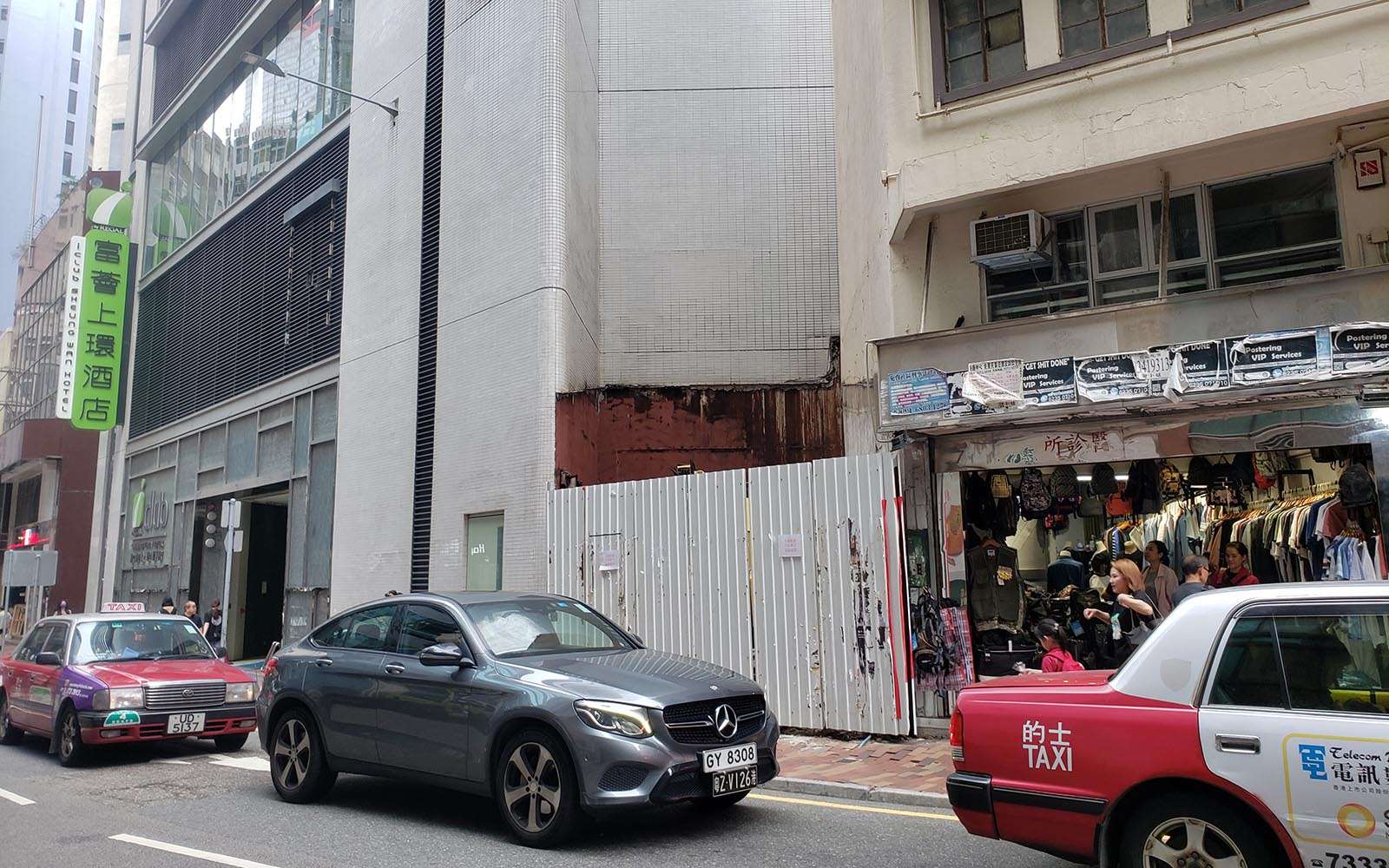
At first, there does not seem to be anything unusual about the tea shop at 14 Bonham Street, until you look up and notice the empty space above it. Unlike every other storefront in the neighbourhood, it has no upper floors. It is not part of another building’s podium. It occupies its own free-standing 100 square foot (9.3m2) structure, wedged into a triangular gap between two other buildings.
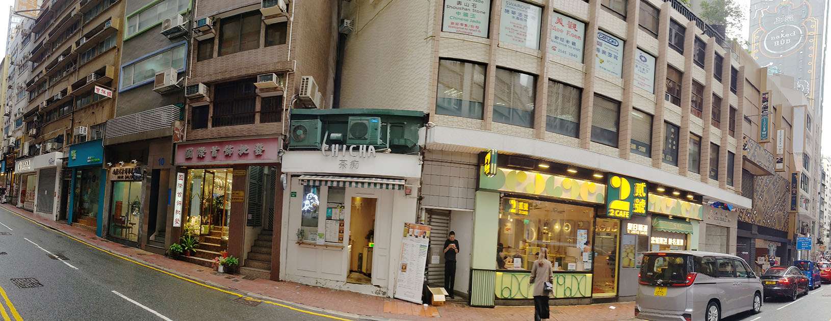
The 100 square foot tea shop at 14 Bonham Strand. Photo credit: City Unseen.
It is not, as you might think, an illegal structure. It has its own land lot, numbered IL 6618 (IL stands for “Inland Lot”). Although the current building is not very old, the lot boundaries have existed for over 120 years. The land under it was created by Hong Kong’s first major public reclamation project; in 1851, a fire devastated some 450 buildings in Sheung Wan. The rubble, plus some additional fill material, was dumped into the sea, forming an irregularly shaped patch of land between Queen’s Road, which followed the original coastline, and Bonham Strand. This area was divided into several irregularly shaped blocks, which were in turn divided into land lots for sale. 14 Bonham Strand was originally part of a large triangular lot sold as Marine Lot No. 6.
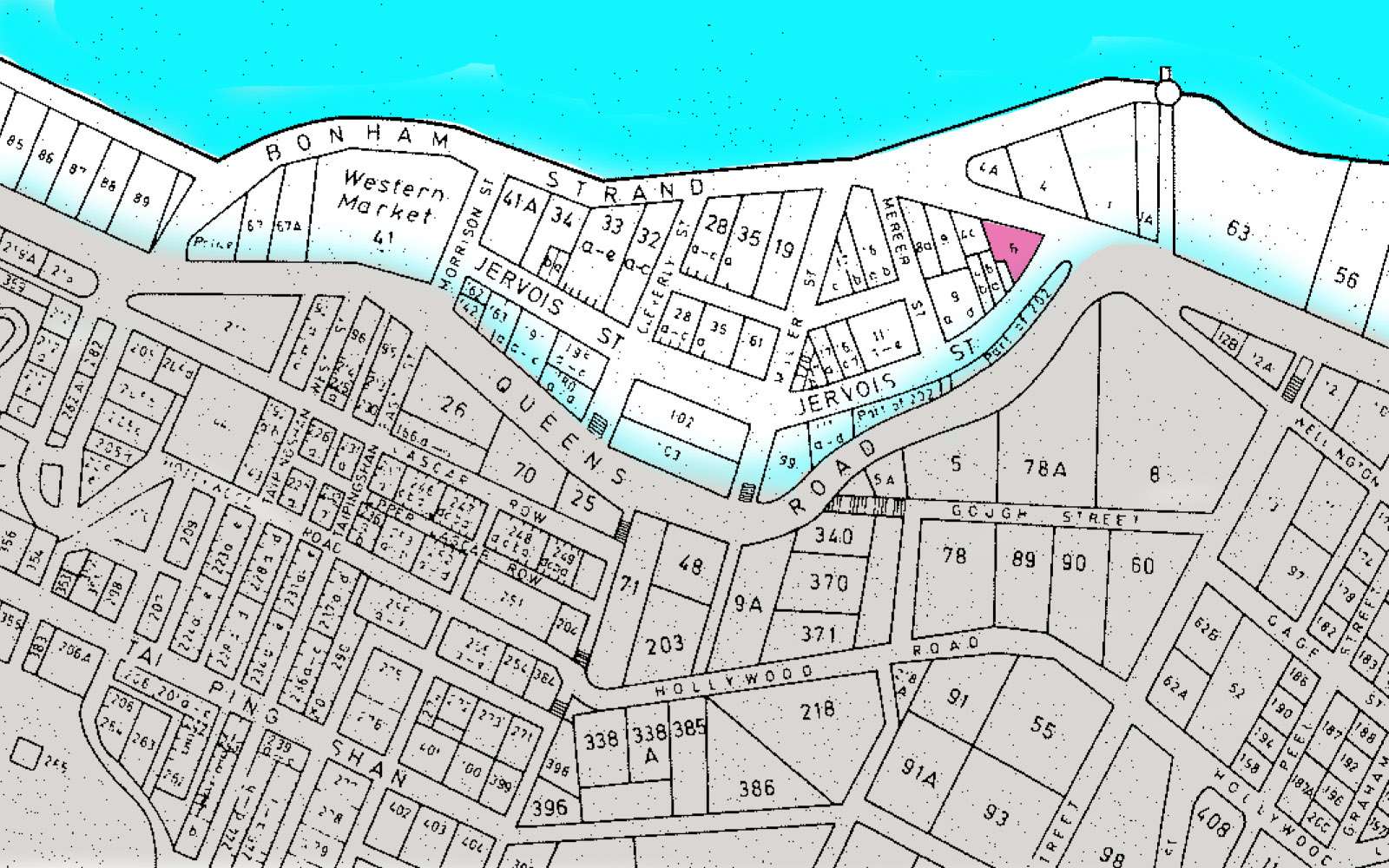
Plan of Victoria, 1856, Hong Kong Public Records Office. Bonham Strand formed the new coastline. Marine Lot no. 6, where the 14 Bonham Strand is located, is coloured in pink.
By the 1890s, these larger lots had been further subdivided into small sublots for individual buildings. This inevitably resulted in several triangular lots scattered throughout the neighbourhood. What kind of buildings were built on such tiny, oddly-shaped lots?
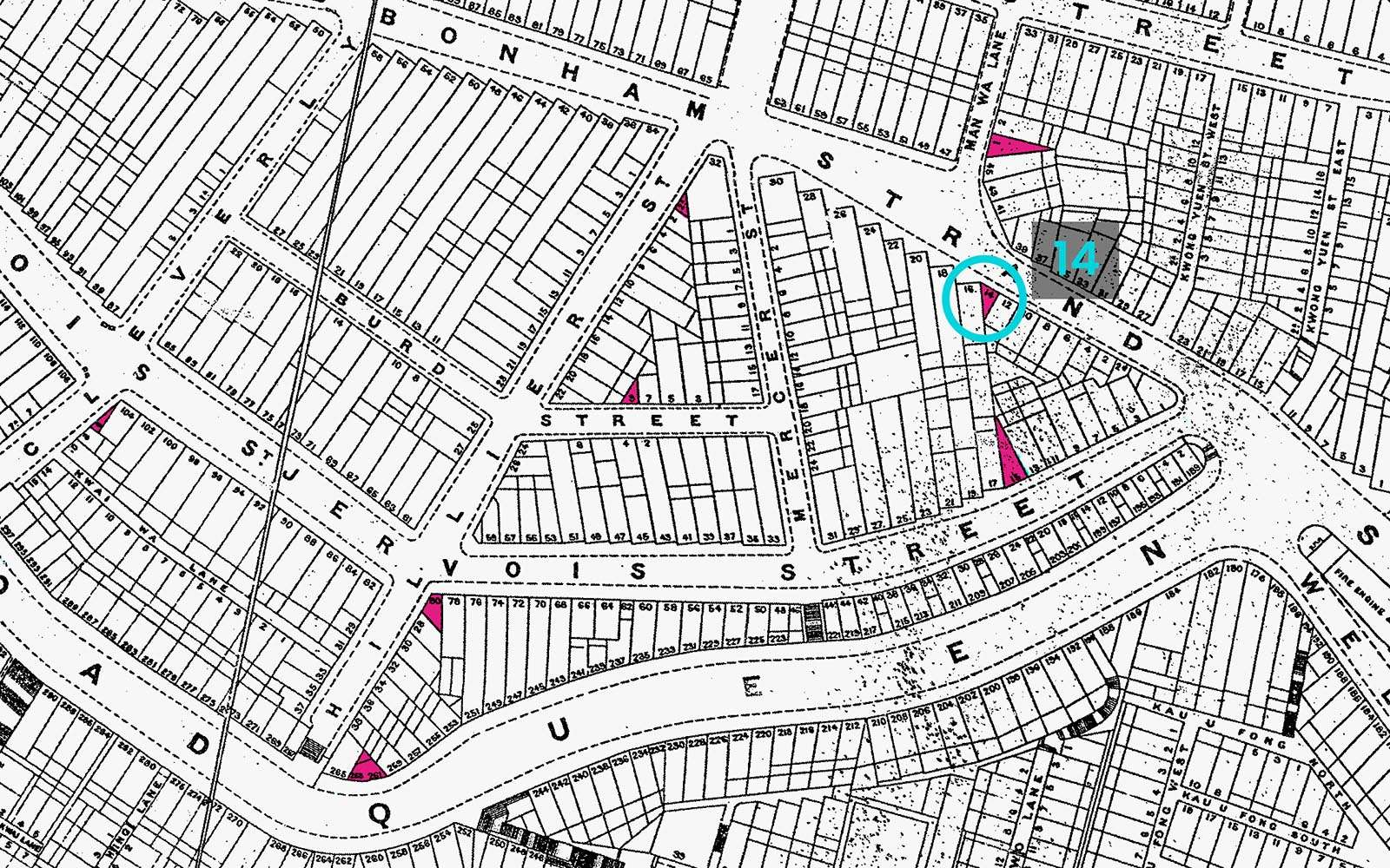
Plan of Hong Kong, 1897, Lands Department Open Data. Large lots were further subdivided, creating several triangles.
Bonham Strand was a thriving, ethnically Chinese commercial-residential district that reached its peak by the turn of the 20th Century. The neighbourhood was home to Nam Pak Hong, an association of “north-south trading companies” engaged in the import-export business. They shipped goods between mainland China and Southeast Asia, Japan, the United States, Europe and Africa, dealing primarily in rice, seafood and medicinal ingredients. Fuelled by gold rushes in the United States, Australia and Canada, a large number of gold and silver trading companies also concentrated here. Perhaps due to its prosperity, Bonham Strand was heavily photographed during the early 20th Century. Photos from the 1920s show a street filled with two to four storey tong laus (shophouses), which were typically just 4.5m wide (15 feet) along their street frontage, but up to 12m (40 feet) deep. Many of them had iron cantilevered balconies, which was fairly typical of second generation tong laus. In the photo below, 14 Bonham Strand lies just out of view on the left side of the street.
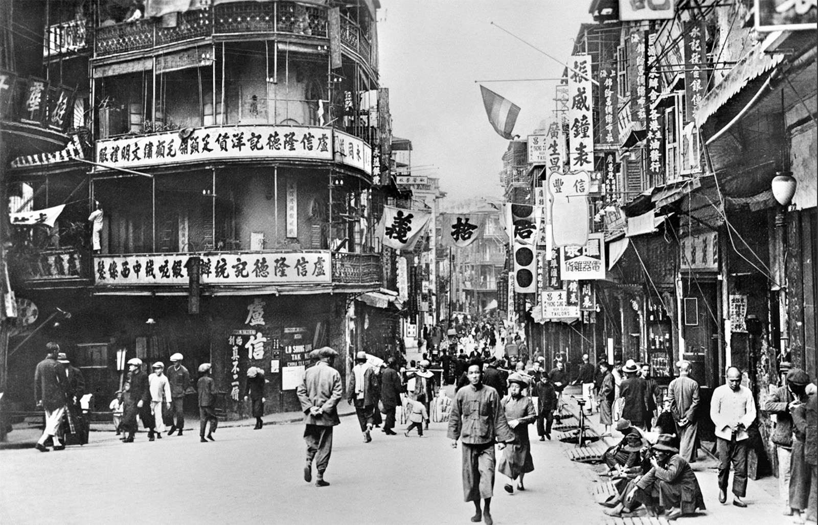
Bonham Strand at the intersection of Jervois Street in the 1920s. Frank Fischbeck collection, copyright of University of Hong Kong Libraries and WYNG Foundation, 2024.
We did manage to find one photograph showing a three-storey building at 14 Bonham Strand in 1947. It was taken by the American photographer Mark Kauffman for Life Magazine, but unfortunately the image is copyrighted and we do not have permission to show it here. (If you click on the link above, it is the fifth building from the right, the shorter one with no balcony.) Therefore, we created a 3D artist’s impression to show how this improbable structure would have fit into such a small lot. We also located its floor plans at the Public Records Office, which reveal an awkwardly angled, incredibly steep staircase crammed into the rear of the building. A person would have had to climb onto the first step sideways; and assuming a storey height of about 3m (10 feet), each step would have been about 30 cm (12 inches) apart in height, but only 10 cm (4 inches) deep.
Artist’s impression of 14 Bonham Strand in 1947, approximate only.
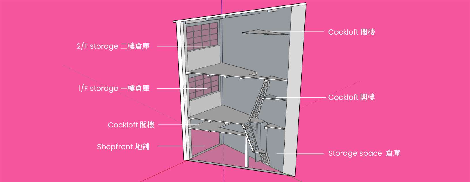
Cross-section of 14 Bonham Strand based on 1973 floor plan, Government Records Service HKRS378-3-1833.
We know that the three-storey building survived until the early 1970s. Ongoing redevelopment in the neighbourhood destabilized many of the older buildings, so in March 1973, the Buildings Authority declared Bonham Strand 8, 10 and 12 to be dangerous. Since their demolition would also destabilize nos. 6 and 14, they would have to be demolished as well.
Mandatory demolition orders under Section 26 of the Buildings Ordinance for nos. 8, 12 and 14 were gazetted on 2 November 1973. (It is not clear why nos. 6 and 10 were excluded, but it is likely that their owners had already started to demolish them.) Under the Demolished Buildings (Re-development of Sites) Ordinance, owners had to pay compensation to protected tenants evicted by demolitions. Hence, from a government notice gazetted on 15 February 1974, we learn that all three floors of the tiny triangular building were occupied by a shop called Shun Cheung Wool Yarn, and its proprietor was awarded HK$8,000 in compensation. Although $8,000 was a significant sum in 1974—the average factory worker made HK$23/day—this was much less than the HK$22,500 collectively awarded to the tenants of 12 Bonham Strand, a building with about 2.6 times the footprint.
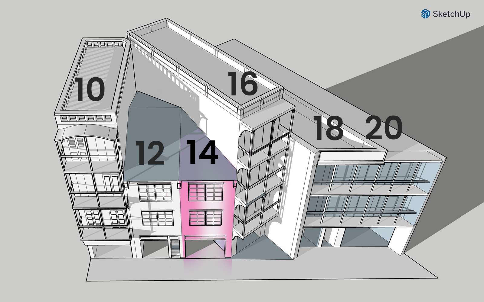
From the demolition orders, we also learn that 8, 12 and 14 Bonham Strand had different owners. We do not know why the owners of no. 14 did not sell their land so that it could be incorporated into a larger project, but in the end, nos. 4, 6 and 8 were combined, and nos. 10 and 12 were redeveloped individually. On the opposite side, nos. 16-20 had already been redeveloped in 1965, so no. 14 was left on its own.
With such a small footprint, it is virtually impossible to build anything taller than a single-story building that meets 20th Century building safety and fire regulations. This makes No. 14 Bonham Strand an outlier, as nearly all of the triangular lots in the neighbourhood have been amalgamated into larger developments. Until relatively recently, two tiny lots measuring 102 square feet (9.4m2) and 300 square feet (28m2) existed at 140 and 142 Bonham Strand, respectively. They were occupied by single storey storefronts until around 2011, when no. 140 was absorbed by the iClub Sheung Wan Hotel redevelopment scheme. Today, no. 142 sits vacant, surrounded by construction hoarding. Who knows what will be built there in the future?
Empty lot at 140 Bonham Strand, May 2024. Photo credit: City Unseen. The sharp corner of the hotel building was a triangular lot incorporated into the development in 2011-14.
Chinese University of Hong Kong, Hong Kong Institute of Asia-Pacific Studies, “Lecture Series on ‘Bonham Strand: When East Meets West and South Meets North’”, December 2019.
Environmental Protection Department, “Consultancy Agreement No. NEX/1023, West Island Line Environmental Impact Assessment, Final Environmental Impact Assessment Report, Appendix 6.1: Reclamation History”, May 2008, HKSAR Government.
Hal Empson, Mapping Hong Kong: A Historical Atlas (1992), Hong Kong: Government Information Services; First Edition.
Lands Department, 1897 Hong Kong Map, Open Data, HKSAR Government.
Lands Department, Geoinfo Map, HKSAR Government.
Mark Kauffman, “Hong Kong”, B/W negative, March 1947, LIFE Photo Collection.
Nam Pak Hong, “An Introduction to Nam Pak Hong Association,” 22 February 2024.
Naomi Ng, “How Hong Kong’s first land reclamation project sprang from a devastating fire”, South China Morning Post, 10 December 2018.
Regal REIT Estate Investment Trust, “2014 Interim Report”, 26 August 2014.
Secretariat for Home Affairs Tenancy Inquiry Bureau, “No. 14 Bonham Strand” (Floor plans of dangerous building), 9 March 1973, Government Records Service, HKRS378-3-1833.
The Hong Kong Government Gazette, “Demolished Buildings (Re-development of Sites) Ordinance (Chapter 337)” G.N. 2861, G.N. 2682, and G.N. 2863, 2 November 1973.
The Hong Kong Government Gazette, “Demolished Buildings (Re-development of Sites) Ordinance (Chapter 337) Notice of Final Awards under Section 9,” G.N. 410, G.N. 411, and G.N. 412, 15 February 1974.
Wah Kiu Yat Po, 〈文咸東街危樓五間住客早遷不必封閉〉(“Five dangerous buildings in Bonham Strand, need not be closed if tenants move out early”), 3 March 1973.
For the 2024/25 Coastal Trail Challenge, we are collaborating with Parks and Trails to highlight stories behind some..
Perhaps you have seen this somewhere: a set of metal double doors, set into the wall of a..
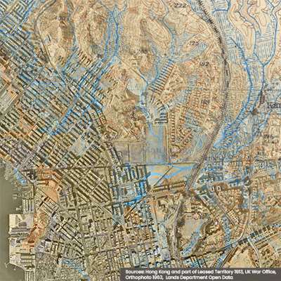
Part 1 of this series recounted the disappearance of small urban streams that were channelled underground during the..
If you look at an old map of Hong Kong, one of the first things you will notice..