
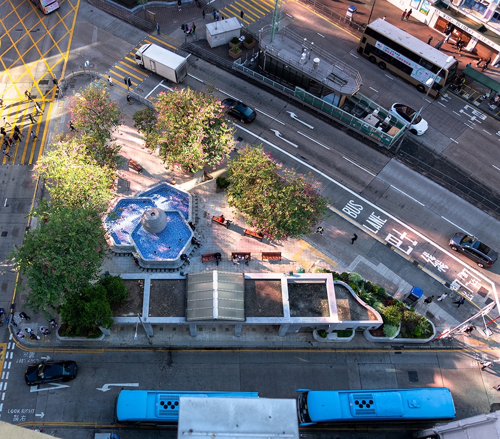
Overhead shot of the Mong Kok Civic Triangle
Overhead shot of the Mong Kok Civic Triangle
If you travel along Nathan Road heading north, at Prince Edward, the entire street grid bends 45 degrees to the left. The result is triangles.
If you travel along Nathan Road heading north, at Prince Edward, the entire street grid bends 45 degrees to the left. At Bute Street, Lai Chi Kok Road branches off diagonally from Nathan Road, stretching towards Sham Shui Po. When Nathan Road reaches Boundary Street, it too turns 45 degrees and becomes Cheung Sha Wan Road. Where the diagonal streets intersect the north-south and east-west streets, triangles are formed. Prince Edward is full of triangles, some large enough to place buildings, and others barely big enough for a few potted plants.
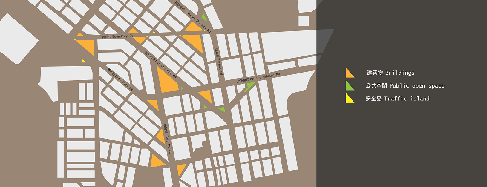
Map of triangular plots of land in Prince Edward
These leftover triangles define the fabric of the neighbourhood of Prince Edward in subtle but distinctive ways. Triangular lots produce triangular buildings. While not every triangular building possesses a distinctive rounded corner, there are three examples on Lai Chi Kok Road alone.
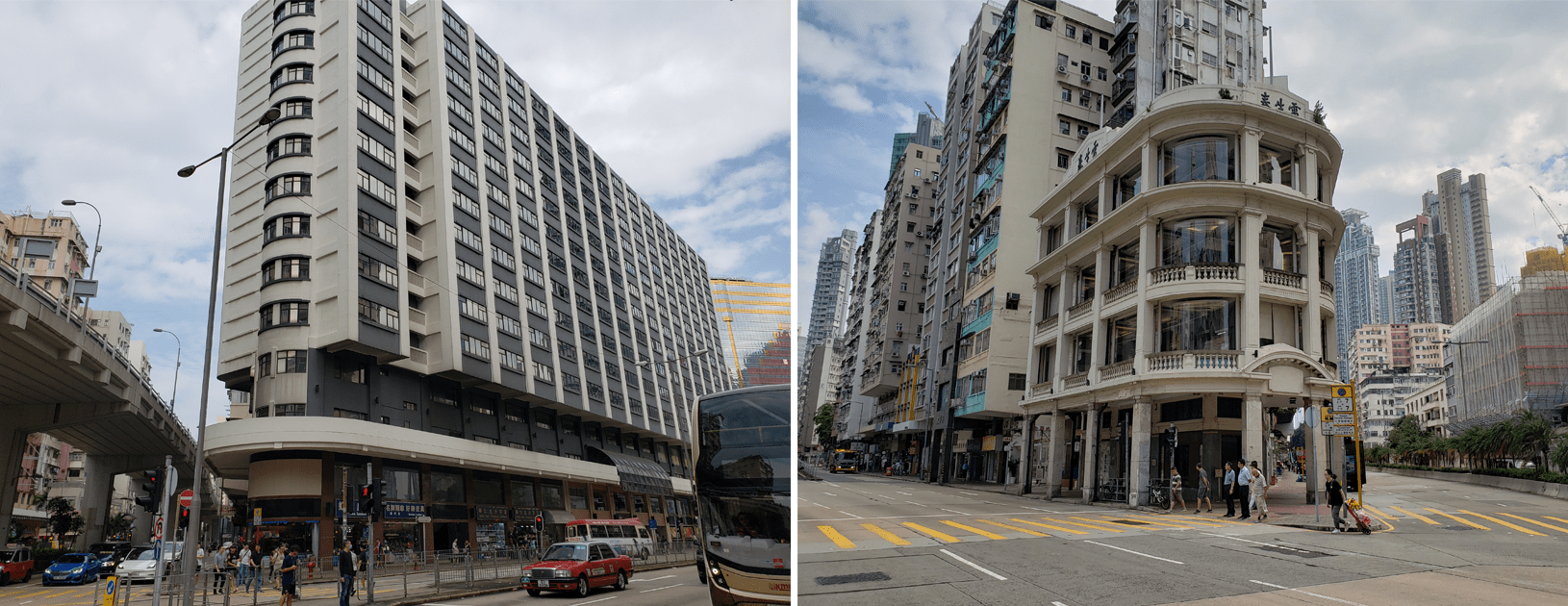
Metropark Hotel (left) and Lui Seng Chun (right). Photo credits: City Unseen.
First, at the intersection with Prince Edward Road is the Metropark Hotel, built in 1990. Its most spacious rooms occupy the slightly rounded corner.
Second is Lui Seng Chun, a 1931 declared monument. It was known in the neighbourhood as “the ghost house” before it was renovated into a Chinese medicine centre run by Baptist University.
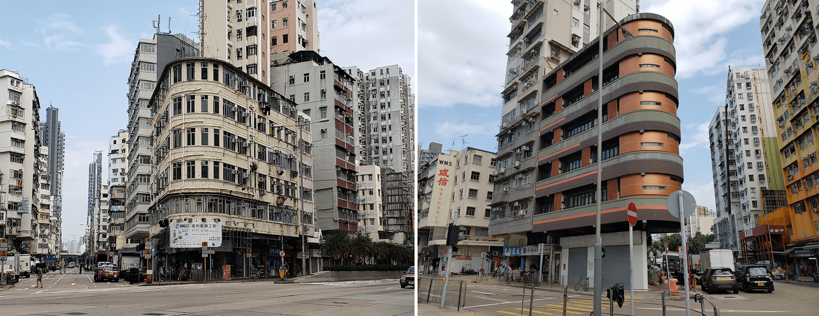
Left: 194-196 Lai Chi Kok Rd. Right: 14 Nam Cheong St. Photo credits: CityUnseen.
Third is 194-196 Lai Chi Kok Road, a 1959 tong lau which sits at the intersection of Boundary Street. The corner shop on its ground floor makes the blue metal trolleys so typical of Hong Kong delivery workers.
As a final example, at the western end of Boundary Street is a small triangular site on which sits 14 Nam Cheong Street, a 1964 tong lau which sat empty for 20 years before being bought by an investment company and given a new, controversial bronze coloured façade in 2019.
Then, there are the triangles that serve as tiny public open spaces. From the end of World War II through the 1990s, the Urban Council was responsible for the provision of public parks and municipal services (it was abolished by Chief Executive Tung Chee-hwa in 1999 and replaced with the Leisure and Cultural Services Department and Food and Environmental Hygiene Department). It was aware of the intense shortage of open space in Mong Kok and Sham Shui Po, and knowing that any major improvements would have to wait for urban renewal, seized any opportunity to turn even the smallest plots of vacant land into recreational spaces. The leftover triangles that were too small for any other use provided such an opportunity.
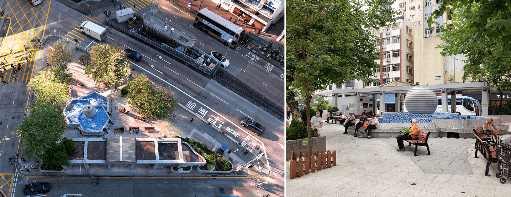
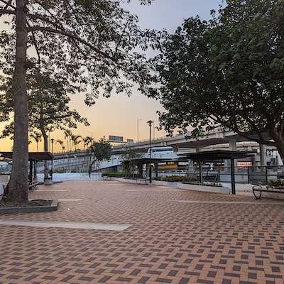
Mong Kok Civic Triangle. Photo credit: Joshua Wolper (left) and CityUnseen (right).
Possibly the most recognisable of these spaces, with its fountain and bauhinia trees, is the Mong Kok Civic Triangle. It sits at the intersection Lai Chi Kok and Nathan Road opposite Pioneer Centre. This space was a Caltex petrol station until its lease expired in 1987, when the Mong Kok District Board decided to turn it into a small plaza. Caltex filed an objection to being removed from the site, and counter-proposed building a sitting-out area on the rooftop of the petrol station. This suggestion was rejected by the Town Planning Board on grounds of safety and inaccessibility. Today, people can be found sitting on the benches in spite of the heavy traffic all around. It seems to be used especially by passengers waiting to board the Shenzhen-bound coaches that park behind it on Arran Street.
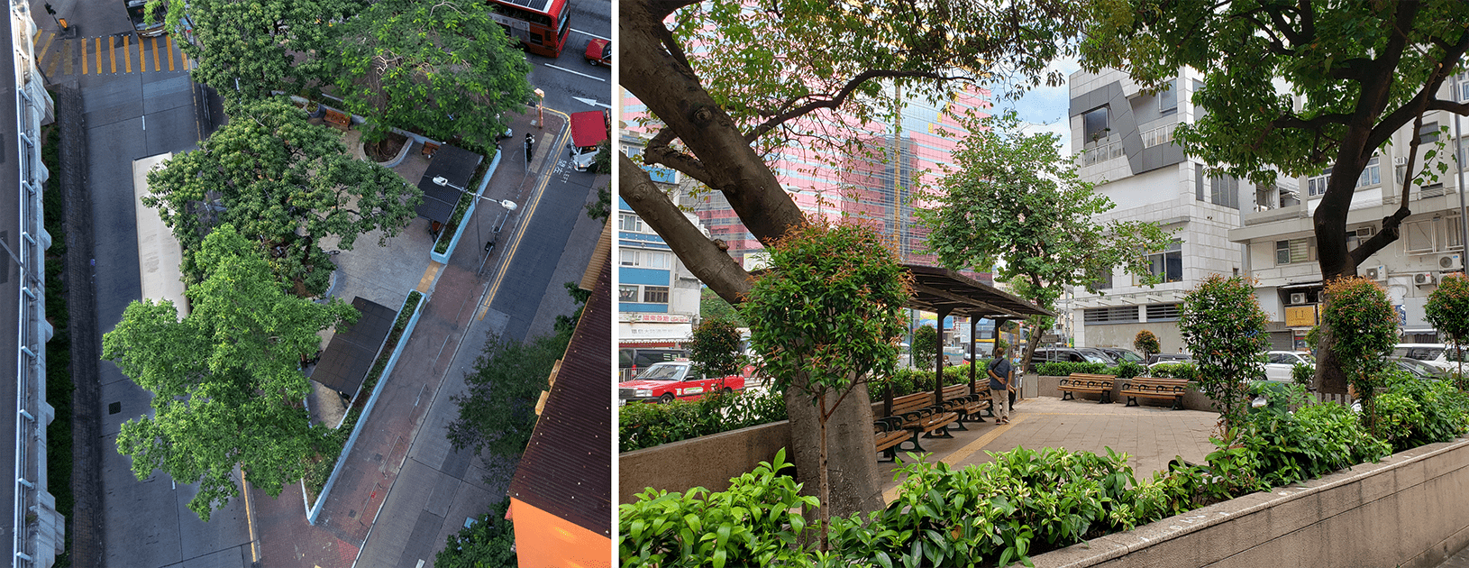
Triangular sitting-out areas along Lai Chi Kok Road at intersections with Canton Road (shown from above, left) and Arran Street (right). Photo credits: Joshua Wolper (left) and CityUnseen (right).
Further down Lai Chi Kok Road are a pair of triangular sitting-out areas built in the 1950s and 60s. The size of the trees is a good indicator of how old these sitting-out areas are. Waist-high planters surround the spaces in an attempt to screen users from traffic noise, but seem to psychologically discourage people from entering. Just a few elderly people can usually be seen resting here.
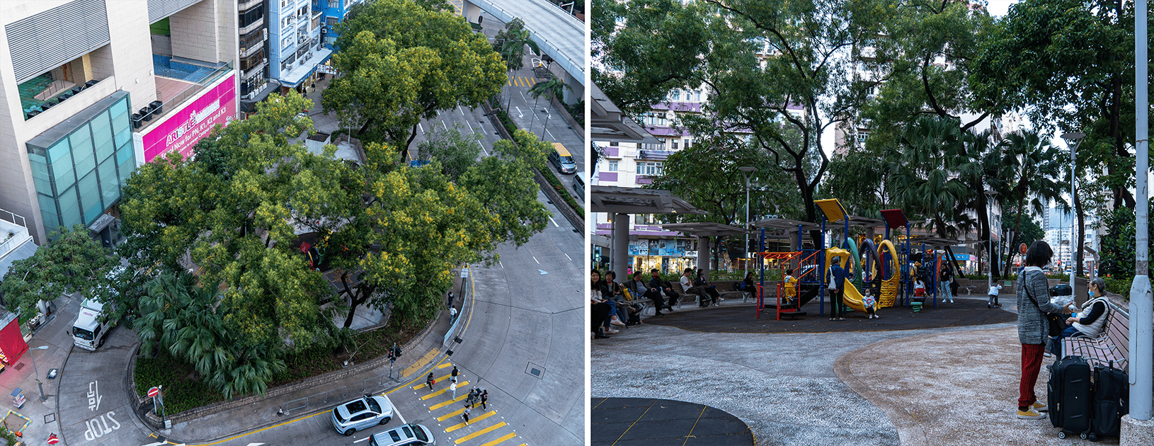
Triangular children’s playground at intersection of Nathan Road and Boundary Street.
Also built in the 1960s was a children’s playground on a pizza-shaped slice of land formed by the intersection of Nathan Road, Boundary Street and Cheung Sha Wan Road. Despite its small size and exposure to heavy traffic noise, it is quite busy on the weekends.
A pair of triangular traffic islands on Boundary Street. The one on the right is frequently used as a storage area or dumping spot for construction materials. Photo credits: Joshua Wolper (left) and CityUnseen (right).
Finally, there are several triangles so small that they can only serve as traffic islands. Regardless, the Planning Department’s zoning plan for Mong Kok still marks out two of these tiny triangles as “open space”. In one case on Maple Street, the open space zone covers a road on one side of the triangle, indicating some long-ago, unrealised intention to close that street to traffic and incorporate it into a sitting-out area.
All of these triangles seem like an inefficient use of space, so how were they created in the first place? To find out, read Part 2 of this series where we will look at the history of how Mong Kok, Sham Shui Po and Tai Kok Tsui’s street layouts developed.
Urban Council, Objection to the Draft Mong Kok Outline Zoning Plan No. S/K3/1, UC.REC.71.88, 7 July 1988
Urban Council, 547MR – Open Space at Junction of Nathan Road and Lai Chi Kok Road (Mong Kok Civic Triangle), UC.REC.153.90, 30 January 1991.
Urban Council, Amenity Planning Zones: Mong Kok District, UC.RA.197.74, 11 November 1974.
Urban Council, Amenity Planning Zone: Sham Shui Po District, UC.RA.09.73, 17 April 1973.
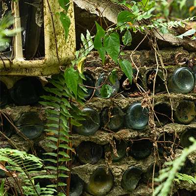
An abandoned, hollowed out fire hydrant sits by an overgrown path in a forest. Its red paint, though..
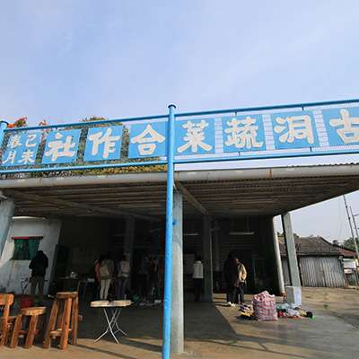
If you walk down main roads in the New Territories, you might notice buildings called “Vegetable Depots” near..
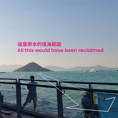
If you follow the Western Harbour Walk on the Hong Kong Island Coastal Trail, you will pass the..
The year is 1869. Hong Kong has been under British rule for 28 years, and it has been..
For the 2024/25 Coastal Trail Challenge, we are collaborating with Parks and Trails to highlight stories behind some..